
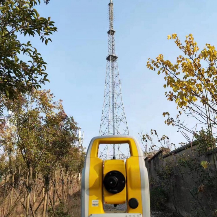

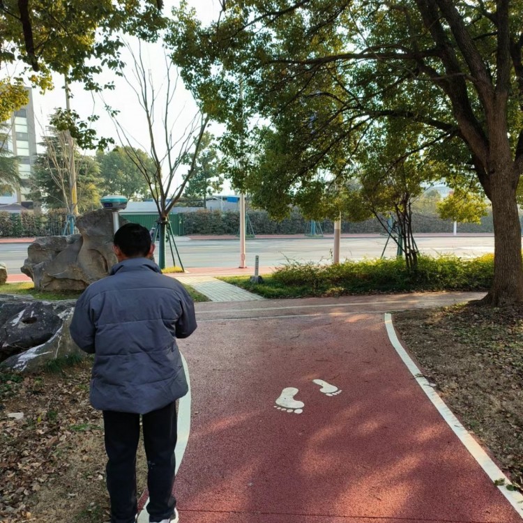
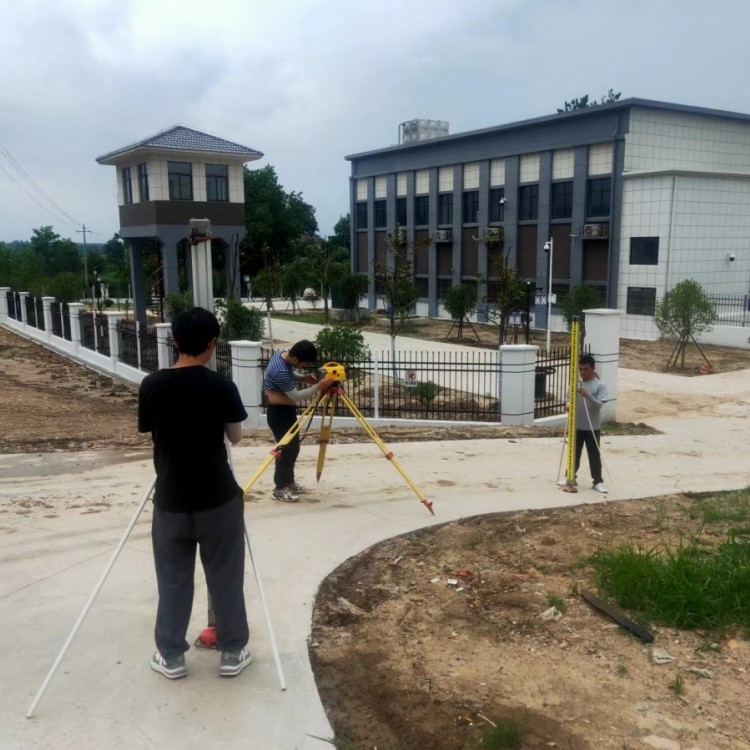


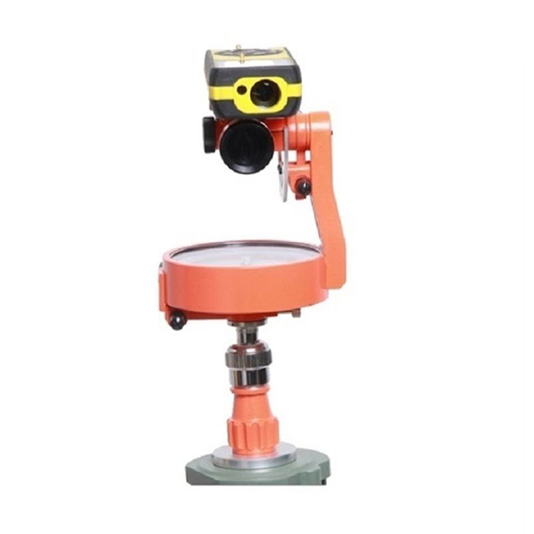
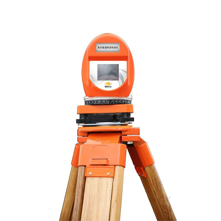
Nanjing Huawei Surveying & Mapping Equipment Co., Ltd. undertakes various surveying and mapping services in Nanjing and its surrounding areas: leveling, topographic surveying, area measurement, earthwork calculation, power surveying and marking, building axis marking, topographic map drawing, aerial topographic surveying, CAD drawing, coordinate and latitude/longitude engineering surveying, foundation pit deformation observation, control point layout surveying, oblique photography, real-time 3D model creation, and a series of surveying projects. The company boasts advanced surveying equipment: 3D oblique photography equipment, 3D laser scanners, Leica 0.5″ precision robots, Trimble DiNi 0.3 leveling instruments, various GPS surveying instruments, total stations, and more.
We offer sales, maintenance, calibration, and engineering survey services for measuring instruments. We undertake GPS engineering surveys and RTK coordinate staking in Nanjing and its surrounding areas, as well as drone and unmanned boat measurements. We provide a one-stop survey and mapping service.
Qianxun Star SE Lite
Compact size, big power
The SeekStar SE Lite is a lightweight product in the SeekStar series, based on the SeekZhichun 5-star 16-frequency service, supporting multi-system satellite signal tracking for BeiDou, GPS, GLONASS, Galileo, and SBAS. Additionally, it features inertial navigation and radio functions. It is compact and lightweight, convenient for surveying operations, and serves as a sufficient yet portable small RTK.
Integrated cloud, continuously deepening
Built-in Kunxun Zhichun 5-star 16-frequency service, supporting BeiDou-3 new system signals, with more satellites acquired, stronger signals, and better anti-interference, the positioning results are more accurate due to the deep integration of hardware and software algorithms.
Compact and easy to carry
The complete unit weighs 900 grams, with a body diameter of just 15 cm, easily held in one hand; it features an ultra-light EPP housing, making it extremely convenient for field use.
Inertial guidance is not picky about the rod.
Built-in high-precision IMU module, 5-second ultra-fast initialization, 30° tip tilt, positioning accuracy within 2cm; 60° tip tilt, positioning accuracy within 5cm, compatible with various alignment rods.
Built-in radio, suitable for various scenarios
The iteratively optimized radio feature supports operation in environments or areas with network or communication signal anomalies, by reducing dependency on the network and signal, making the application scenarios more diverse.
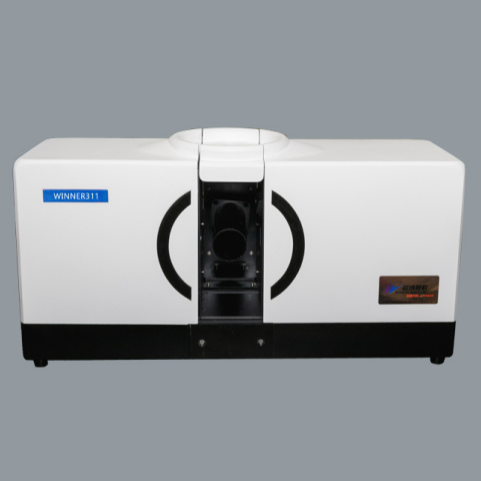
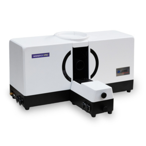
Product Features
● True Color Screen: High-definition color without distortion
●Bluetooth: In-built Bluetooth for long-distance connectivity
● Multiple transmission methods: USB flash drive, serial port, Bluetooth
● Intelligent Online Calibration Software: Fault diagnosis via software
●Dual-axis Compensation: Tilt Correction, Error Reduction
● Precision Ball Screw System: Sturdy body, enhances measurement stability
● Extra Long Prism-Free Ranging: 1000m Prism-Free Ranging
● Side round measuring key: One-key measurement, faster
● Temperature and Pressure Sensing: Automatic Sensing of Temperature and Pressure
We offer sales, maintenance, calibration, and engineering survey services for measuring instruments. We undertake GPS engineering surveys in Nanjing and surrounding areas, including RTK coordinate layout, unmanned vessel measurements, and one-stop surveying and mapping services.
We undertake surveying projects, including topographic surveying, cadastral surveying, GPS surveying, control surveying, municipal engineering surveying, line surveying, building surveying, settlement observation, construction layout, completion surveying, steel structure surveying, large equipment installation surveying, urban planning alignment and land allocation surveying, etc.
Company now offers GPS RTK rental services: RTK rental, RTK lease, Nanjing RTK rental, Jiangsu RTK rental, Trimble RTK, Topcon RTK, Sandu RTK, SuYiguang RTK, Leica RTK, Pentax RTK, Nikon RTK, Topcon RTK, Sokkia RTK, RTK daily rental, RTK monthly rental
Nanjing Dynamic GPS Rental
Nanjing Static GPS Rental
Jiangsu Province Measurement Instrument Rental
Nanjing Surveying Equipment Rental
Instrument Rental & Leasing
Nanjing Total Station Rental
Nanjing leveling instrument for engineering survey rental
Nanjing Theodolite Rental for Instrument Measurement
Total Station, Theodolite, Level, Plumb Bob, Tying Out Tool, Two-way Radios, and various surveying equipment for rent or lease
Comprehensive product range, exceptional service, and expert technology
The company now offers GPS RTK rental services: RTK rental, RTK lease, Nanjing RTK rental, Jiangsu RTK rental, Trimble RTK, Kolida RTK, Sanding RTK, Sunyiguang RTK, Leica RTK, Pentax RTK, Nikon RTK, Topcon RTK, Sokkia RTK, RTK daily rental, RTK monthly rental.
Nanjing Dynamic GPS Rental & Lease
Nanjing Static GPS Rental
Jiangsu Province Measurement Instrument Rental
Nanjing Surveying Equipment Rental
Equipment Rental
Nanjing Total Station Rental
Nanjing Level Instrument for Surveying Equipment Rental
Nanjing Theodolite Rental & Lease
Total Station, Theodolite, Level, Plumb Bob, Tying Out Instrument, Walkie-Talkie, and various surveying equipment rentals
Comprehensive products, excellent service, and sophisticated technology.
Solve all your measurement issues!
Buy with peace of mind! Rent with comfort! Use with ease!