


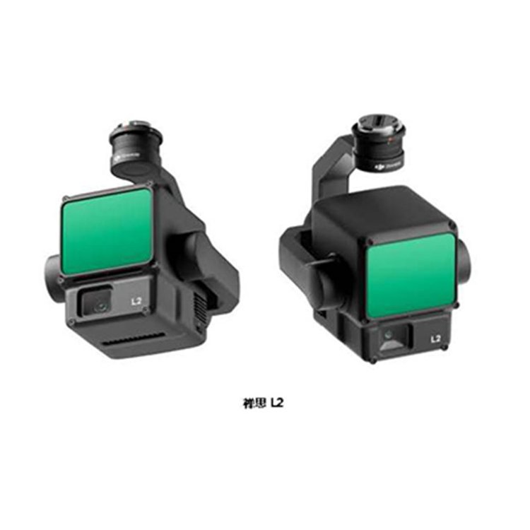


DJI Laser Point Cloud Camera ZenmuseL2 Technical Specifications
ShenzhenPengjin Technology drone technology team, contact phone number18320930028 Miss Lai
The company offers a variety of drones./Laser Radar / Oblique Photogrammetry / Multispectral / Hyperspectral and other loading solutions

Technical Specifications
Overall Parameters
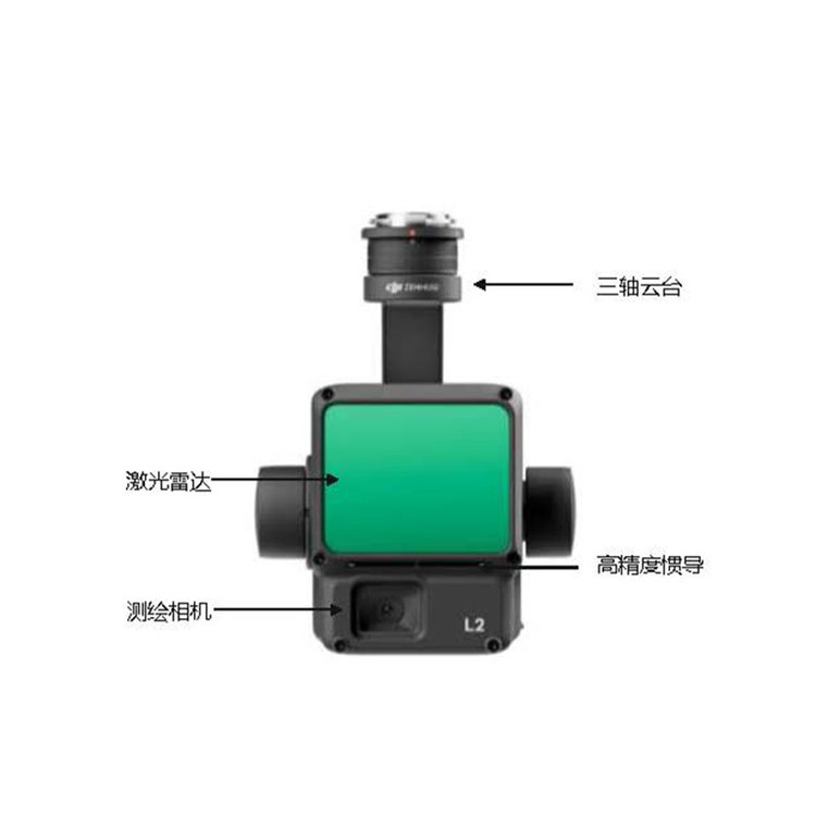
Product Name
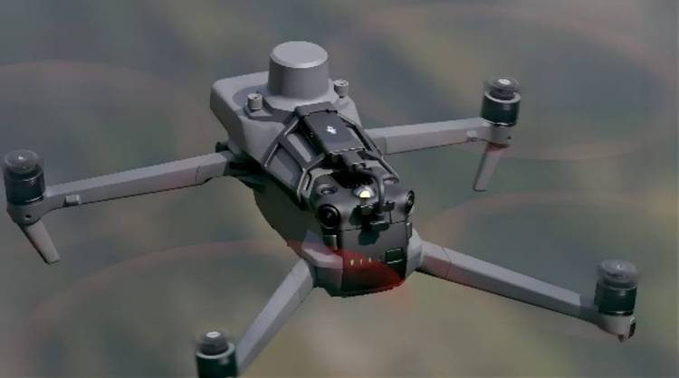
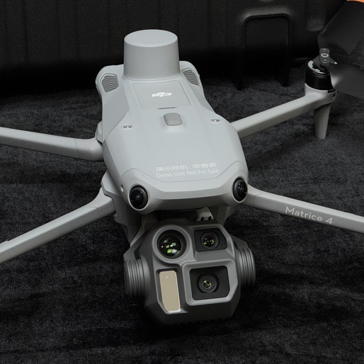
Contemplation L2
Dimensions
Long 155mm x 128mm x 176mm
Weight
905 ± 5 grams
System Power Consumption
28 W (typical) / 58 W (max)
Protection GradeIP54
Supported Models
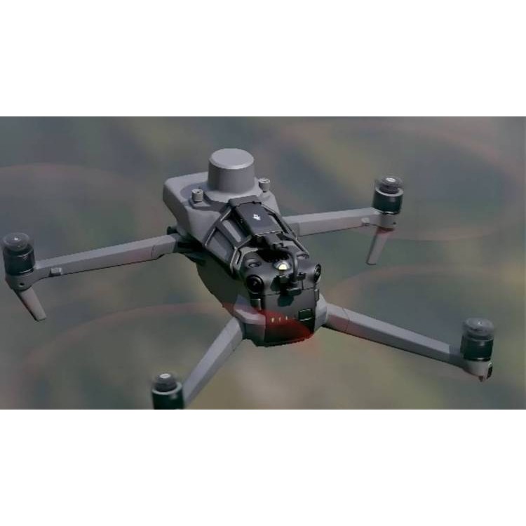
Longitude and latitude M300 RTK (requires use with DJI RC Plus)
Matrice 350 RTK
Storage Temperature-20°F to 60°F
System Performance Range450 meters (reflectivity 50%, 0 klx)
250 meters (Reflectivity 10%, 100 klx)
The above data represents typical values. Test conditions: flat target, target size larger than the diameter of the laser beam, atmospheric visibility of 23 kilometers, laser vertical incidence. Additional note: The range is shorter on sunny days compared to cloudy days; if a laser beam hits more than one target, the laser pulse energy is dispersed, which may reduce the measurable distance; the measurement range ends at 500 meters.
Point Cloud Data Rate
Single EchoUp to 240,000 points/second
Multiple EchoesUp to 1,200,000 points/second
System Accuracy
Flatness Accuracy:5 cm @ 150 m
Elevation Accuracy:4 cm @ 150 m
DJI Outdoor Test Site, under the following conditions: Zenmuse Mounted on Matrice 350 RTK and powered on, plan the surface route using DJI Pilot 2 (with IMU calibration enabled), in duplicate scan mode, with RTK status as FIX, relative flight altitude of 150 meters, flight speed of 15 m/s, gimbal pitch at -90°, no straight line segment exceeding 1500 meters in the route, distinct edge features of ground objects, and using bare, hard check points that comply with the diffuse reflection model. Post-processing with DJI Terra, with point cloud precision optimization enabled during processing. Under the same conditions, without point cloud precision optimization, elevation accuracy is 4 cm, and planimetric accuracy is 8 cm.
·
·
Real-time point cloud coloring mode
Reflectivity, height, distance, true color
Laser Radar
Distance Measurement AccuracyRMS 1σ)
2 cm @ 150 m
At ambient temperatures of Measured at 25°C, with a target object reflectivity of 80%, from a distance of 150 meters. Specific values are dependent on testing conditions and are for reference only; please refer to actual measurement results.
ZUILarge number of support echoes5
Scan Mode Non-repetitive scanning, repetitive scanning
FOV
Repetitive Scanning: Horizontal 70°, vertical 3°
Non-repetitive Scanning: Horizontal 70°, vertical 75°
ZUISmall measurement distance3 meters
Laser divergence angle
Level 0.2 mrad, vertical 0.6 mrad
Measured under semi-high width conditions.0.6 mrad indicates that for every 100 meters of distance, the diameter of the laser beam increases by 6 centimeters.
·
Laser Wavelength
905 nm
Laser Spot Size
Level 4 cm, vertical 12 cm @ 100 m (FWHM)
Laser Pulse Emission Frequency240 kHz
Laser Safety Class
Class 1(IEC 60825-1:2014)
Reach Maximum Emission LimitAEL)
233.59 nJ
Reference Diameter
Effective Bore 23.85 mm (equivalent circular diameter)
5 nanosecond laser pulseZUIHigh transmission power46.718 watts
Inertial Navigation System IMU update frequency
200 Hz
·
·
Accelerometer Range±6g
Angular Velocity Measurement Range±300dps
Course AccuracyRMS 1σ)
Live:0.2°, post-processing: 0.05°
DJI Outdoor Test Site; Zhen Shi Mounted on Matrice 350 RTK and powered on, planning flight paths with DJI Pilot 2's surface flight plan (with IMU calibration activated), RTK status is FIX, relative flight altitude is 150 meters, flight speed is 15 meters/second, gimbal pitch is -90°, and no straight line segment in the flight path exceeds 1500 meters.
Pitch & RollRoll Precision (RMS 1σ)
Real-time:0.05°, post-processing: 0.025°
DJI outdoor testing facility and under the following conditions: Zenmuse Mounted on Matrice 350 RTK and powered on, the surface flight path is planned using DJI Pilot 2 (with IMU calibration enabled), RTK status is FIX, relative flight altitude is 150 meters, flight speed is 15 m/s, gimbal pitch is -90°, and no straight line segment in the flight path exceeds 1500 meters.
Horizontal positioning accuracy
RTK Fix: 1 cm + 1 ppm
Vertical positioning accuracy
RTK Fix: 1.5 cm + 1 ppm
Survey Camera
Sensor
4/3 CMOS, 20 million effective pixels
Lens
FOV:84°
Effective Focal Length:24 mm
Aperture:f/2.8 to f/11
Focus on:1 meter to infinity (with autofocus)
Shutter speed
Mechanical shutter:2 to 1/2000 second(s)
Electronic Shutter2 to 1/8000 seconds
Shutter lifespan200,000 times
Photo dimensions5280 × 3956(4:3)
Photo Shooting Mode and Parameters
Single Order:20 million pixels
Timer photography20 megapixels
JPEG Timer Shot Interval: 0.7/1/2/3/5/7/10/15/20/30/60 seconds
Raw/JPEG + Raw timed shot intervals: 2/3/5/7/10/15/20/30/60 seconds
Video encoding and resolution
·
·
H.264
4K:3840 × 2160@30fps
FHD:1920 × 1080@30fps
ISO
Video:100 to 6400
Photo:100 to 6400
Video Bitrate
4K:85Mbps
FHD:30Mbps
Supporting File System
exFAT
Image Format
JPEG/DNG(RAW)
Video Format
MP4(MPEG-4 AVC/H.264)
Tripod specifications
Stable system
3 Axes (Pitch, Roll, Yaw)
Angle jitter amount
0.01°
Installation Method
DJI Skyport Quick Release
Mechanical angle range
Pitch-143°F to +43°F
Slide:±105°
* The above data is for structural limit switches, not for soft limit switches with control.
Controllable rotational range
Pitch-120° to +30°
Slide:±90°
Operation Mode
Follow/Free/Return to China
Data Storage
Raw Data Storage
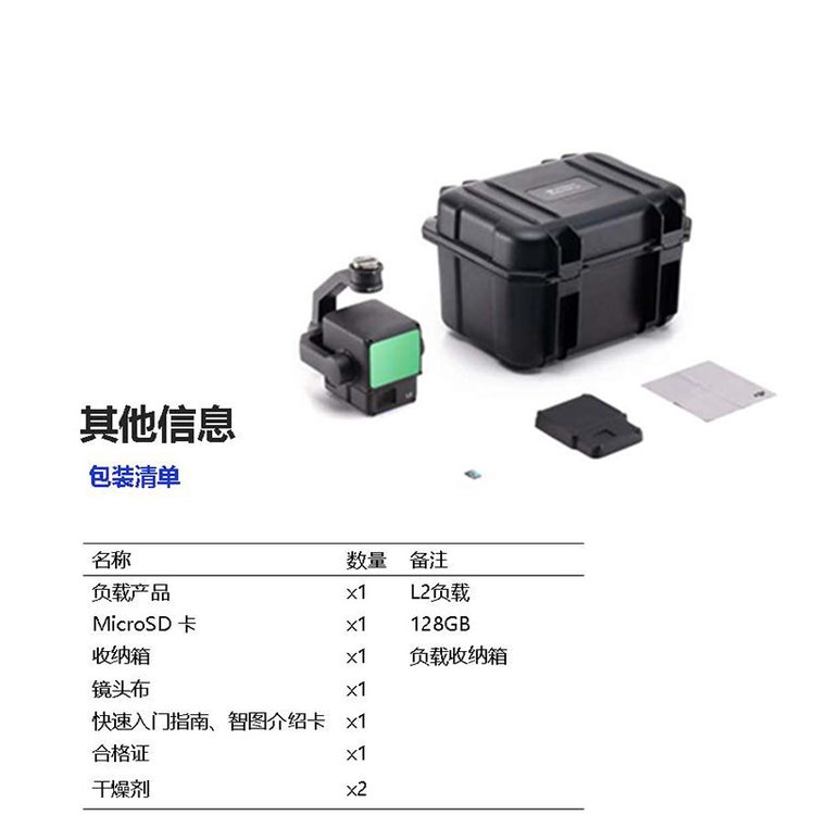
Photo/IMU/Point Cloud Data Storage/GNSS Data/Calibration Files
Point Cloud Data Storage
Real-time Modeling Data Storage
Supported Storage Card Types
microSD cards; supports up to 256GB capacity, sequential write speed ≥50MB/s, transfer speed reaches UHS-I Speed Class 3, please use the recommended storage cards.
Recommended Memory Card Type
Lexar 1066x 64GB U3 A2 V30 microSDXC
Lexar 1066x 128GB U3 A2 V30 microSDXC
Kingston Canvas Go! Plus 128GB U3 A2 V30 microSDXC
Lexar 1066x 256GB U3 A2 V30 microSDXC
Post-processing
Software Support
DJI SmartMap
Data Format
DJI Terra supports exporting point cloud models in the following standard formats:
PNTS/LAS/PLY/PCD/S3MB。
DJI Laser Point Cloud Camera ZenmuseL2 Technical Specifications
The company offers a variety of drones./Laser Radar / Oblique Photography / Multispectral / Hyperspectral and other loading solutions