
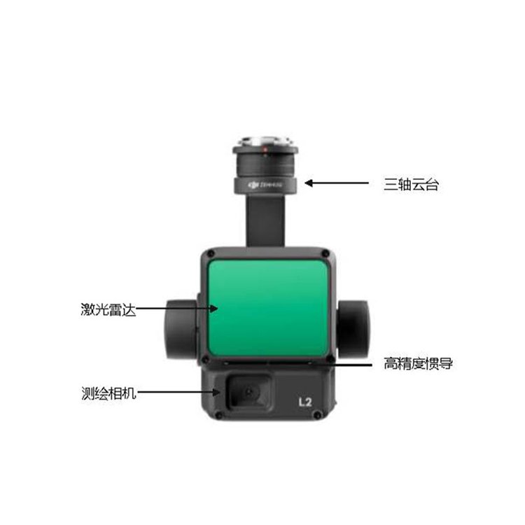


DJI ZenmuseL2 DJI's SmartMap Point Cloud Processing Feature - Free
ShenzhenPengjin Technology drone technology team, contact phone number18320930028 Miss Lai
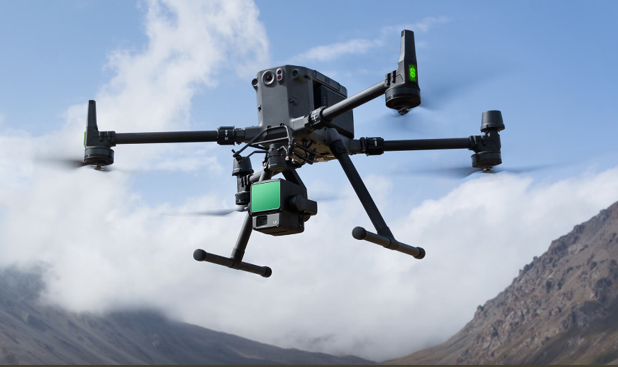
The company offers a variety of payload solutions including drones, laser radar, oblique photography, multispectral, and hyperspectral.
DJI Terra Post-Processing Free: L2 Point Cloud Processing Feature Always FREE

Zenith L2 Advantages
High Precision:At flight altitude of150 meters, accuracy to elevation 4 centimeters, flat 5 centimeters
High Efficiency Rate: Coverage area per flight可达 2.5 km², and accuracy meets 1:500;
High Penetration:Smaller laser spot size, more concentrated energy.
High Range:250 Mi (Reflectivity) 10%,100 klx),450 Meters (Reflectivity) 50%,0 klx),Typical
Operating altitude up to 150 Rice
Five Echo: Maximum Support 5 Echo240,000 points/second point cloud data
Ready to operate immediately Self-developed high-precision inertial navigation system upgrade, no need to wait for warm-up upon startup, directOn-the-job training
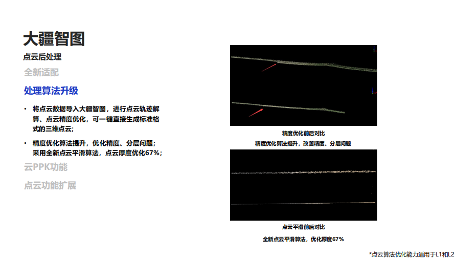
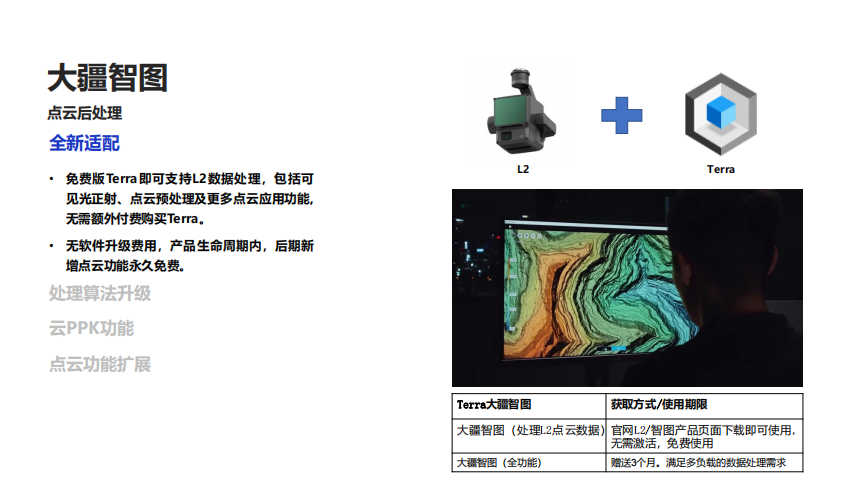
DJI Terra Post-Processing Free: L2 Point Cloud Processing feature is always free.
Zen thoughtL2 DJI's Map Pilot Point Cloud Processing Function Free
ShenzhenPengjin Technology drone technology team, contact phone number18320930028 Miss Lai
The company offers a variety of payload solutions for drones/lidar/oblique photography/multispectral/hyperspectral, etc.