
 DJI Airport 3, deployable in vehicles for unmanned operations
 PJC8 Comprehensive Smart Pipeline Detector
 Daqi Tiancheng SHARE505S PRO 51 Megapixel Medium Format Aerial Camera
 Sel S10 Portable 3D Laser Scanner
 GHJS12 explosion-proof portable 3D laser scanner
 S10 Real-Time 3D Laser Scanner
 DJI Airport 2+ Platform + AI Software
Product Details
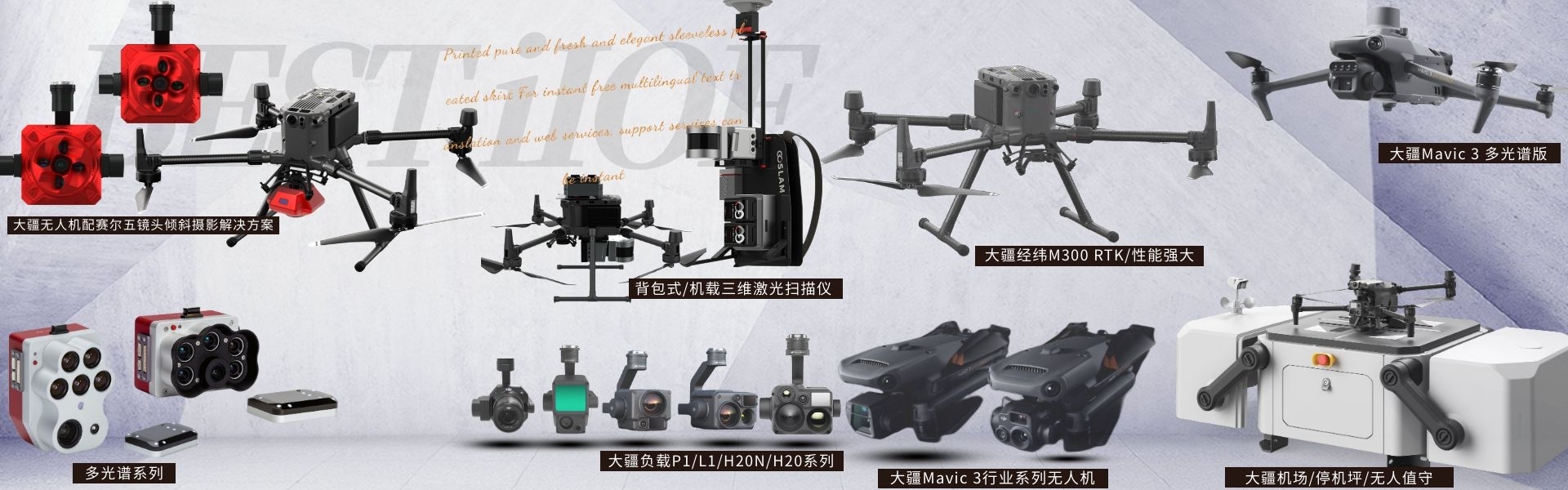
DJI drones and payloads, 3D laser scanners, ground-penetrating radar, multisp...
产品Price Negotiable
最小起订Quantity:1 Set 供货总Quantity: 20 Set


Size |
|
Weight |
905 ± 5 grams |
System Power Consumption |
28 W (typical) / 58 W (max) |
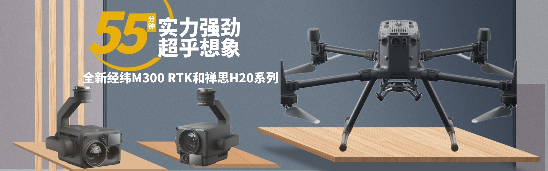
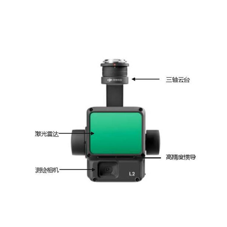
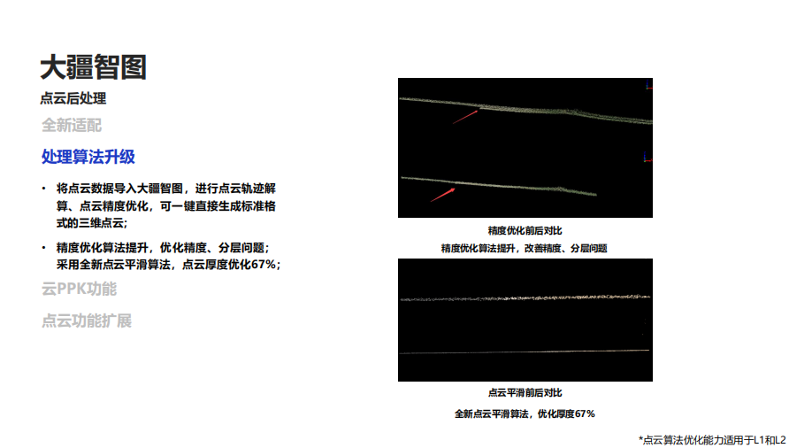
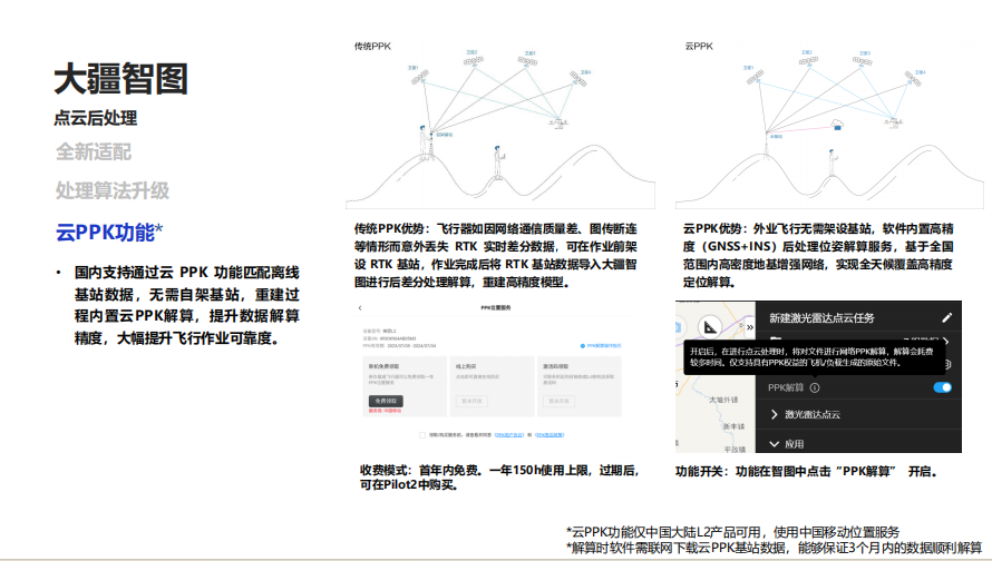
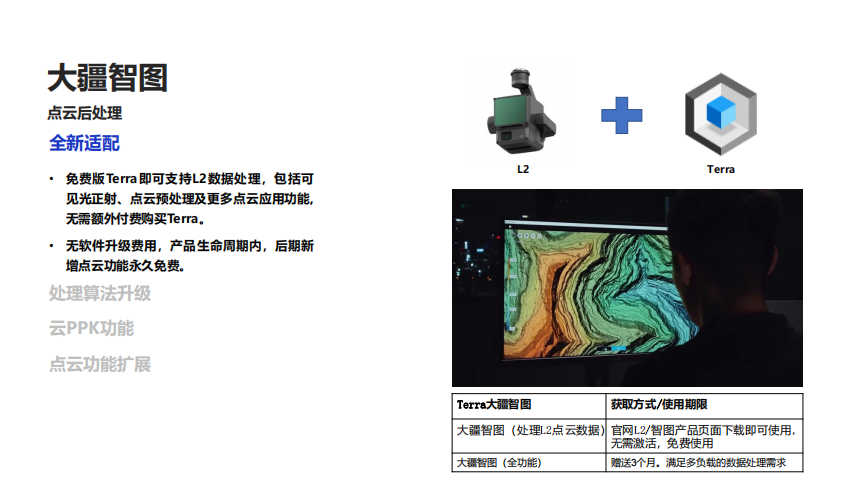
DJI ZenmuseL2 DJI's SmartMap Point Cloud Processing Feature - Free ShenzhenPengjin Technology drone technology team, contact phone number18320930028 Miss Lai The company offers a variety of payload solutions including drones, laser radar, oblique photography, multispectral, and hyperspectral. DJI Terra Post-Processing Free: L2 Point Cloud Processing Feature Always FREE Zenith L2 Advantages High Precision:At flight altitude of150 meters, accuracy to elevation 4 centimeters, flat 5 centimeters High Efficiency Rate: Coverage area per flight可达 2.5 km², and accuracy meets 1:500; High Penetration:Smaller laser spot size, more concentrated energy. High Range:250 Mi (Reflectivity) 10%,100 klx),450 Meters (Reflectivity) 50%,0 klx),Typical Operating altitude up to 150 Rice Five Echo: Maximum Support 5 Echo240,000 points/second point cloud data Ready to operate immediately Self-developed high-precision inertial navigation system upgrade, no need to wait for warm-up upon startup, directOn-the-job training DJI Terra Post-Processing Free: L2 Point Cloud Processing feature is always free. Zen thoughtL2 DJI's Map Pilot Point Cloud Processing Function Free ShenzhenPengjin Technology drone technology team, contact phone number18320930028 Miss Lai The company offers a variety of payload solutions for drones/lidar/oblique photography/multispectral/hyperspectral, etc.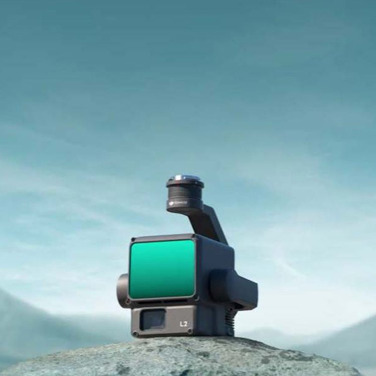

Phone Consultation
QQ Service