
 DJI Airport 3, deployable in vehicles for unmanned operations
 PJC8 Comprehensive Smart Pipeline Detector
 Daqi Tiancheng SHARE505S PRO 51 Megapixel Medium Format Aerial Camera
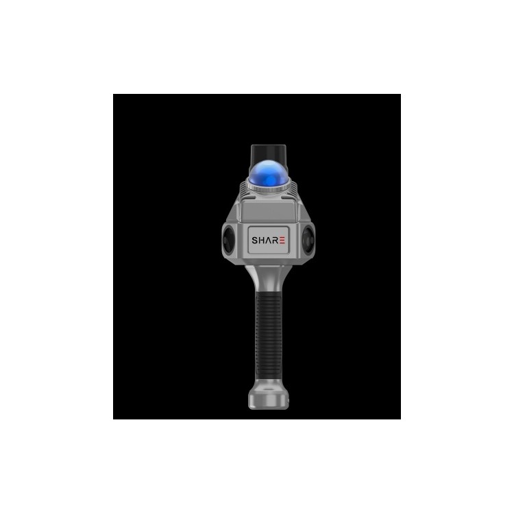
 Sel S10 Portable 3D Laser Scanner
 GHJS12 explosion-proof portable 3D laser scanner
 DJI Airport 2+ Platform + AI Software
Product Details
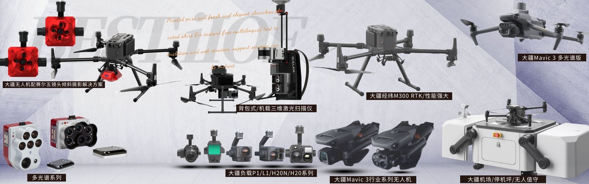
DJI drones and payloads, 3D laser scanners, ground-penetrating radar, multisp...
产品Price Negotiable
最小起订Quantity:1 Tai 供货总Quantity: 20 Tai


Weight |
|
Dimensions |
297.7mm x 103.7mm x 104.8mm |
Operating Temperature |
-20 to 55°C |
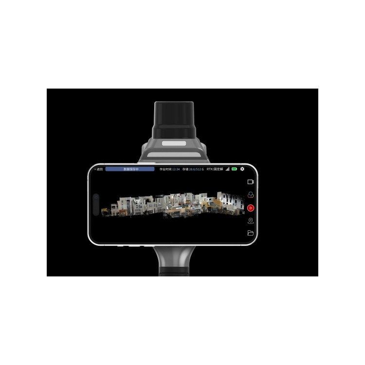
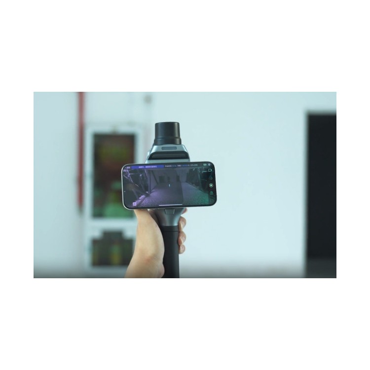
S10 Real-time 3D Laser Scanner Laser radar is installed at a 20° angle to the ground, allowing for coverage of multiple directions including the ground, front, and ceiling. This eliminates the need for repeated angle adjustments during operation, enhancing the efficiency of each scanning task. Camera 135° integrated distribution angle The body is equipped with two self-developed high-resolution wide-angle cameras by Sael, distributed in a 135° angle to expand the image capture range; integrated as a single unit to effectively avoid misalignment from disassembly, combined with microsecond-level time synchronization technology for more precise color rendition. Integrated RTK Positioning Module The SHARE SLAM S10 comes with an integrated RTK module, ready to use without any disassembly; simply press a button to activate. It features a single integrated RTK, achieving microseconds-level synchronization among core sensors like RTK, INS, and camera; supports 7-star 21 frequencies, with RTK positioning accuracy down to centimeter level. Real-time preview of color point cloud computation Compared to external camera solutions, radar scanning point cloud data can be combined in real-time with the image data captured by the camera. With an embedded high-performance processor, it can quickly process massive amounts of point cloud and image data, achieving real-time color point cloud calculation and preview for the industry. Non-closed-loop scanning operation Under stable RTK signal conditions, our proprietary fusion algorithm can generate point cloud data containing geographic coordinates, without the need for closed-loop scanning, providing point cloud data with relative accuracy exceeding 5 cm. picosecond-level time synchronization technology Outstanding self-developed camera image processing algorithms, point cloud image fusion algorithms, and multi-sensor microsecond-level time synchronization technology enhance the accuracy of point cloud coloring, providing more realistic color rendition, with relative accuracy in the point cloud reaching 1 cm. Integrated with MagSafe, one-handed operation The body features built-in Magsafe design, allowing for easy one-handed operation with a simple magnetic click; bid farewell to hand switching troubles and cumbersome operations, enjoying both ease and elegance. Support for working with Apple Vision Pro Supports Apple Vision Pro for scanning tasks, seamlessly integrating emerging concepts and measurement technologies, unlocking new experiences in the metaverse. Real-life Measurement Assistant Tailor-made mobile software for handheld devices, compatible with Android and iOS installations; supports real-time, smooth preview of color point clouds during operations, and allows for downloading and replaying real-time color point clouds on the device. Point Cloud Manager One-stop point cloud data management platform, directly outputting colored point clouds without complex step-by-step operations, generating final results with one click; data processing time is 1:1 with scanning duration; also integrates multiple point cloud tools, supporting synchronized and associated viewing of point cloud and image spaces.
Shenzhen Pengjin Technology Co., Ltd., welcome to inquire at 18320930028, Miss Lai
Laser Radar with 20° Inclination Mounting


Phone Consultation
QQ Service