
 DJI Airport 3, deployable in vehicles for unmanned operations
 PJC8 Comprehensive Smart Pipeline Detector
 Daqi Tiancheng SHARE505S PRO 51 Megapixel Medium Format Aerial Camera
 Sel S10 Portable 3D Laser Scanner
 GHJS12 explosion-proof portable 3D laser scanner
 S10 Real-Time 3D Laser Scanner
 DJI Airport 2+ Platform + AI Software
Product Details
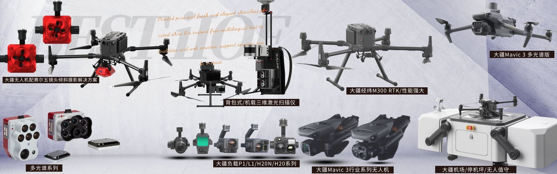
DJI drones and payloads, 3D laser scanners, ground-penetrating radar, multisp...

产品Price Negotiable
最小起订Quantity:1 Set 供货总Quantity: 20 Set


Dimensions |
|
Weight |
905 ± 5 grams |
System Power Consumption |
28W (typical) / 58W (max) |
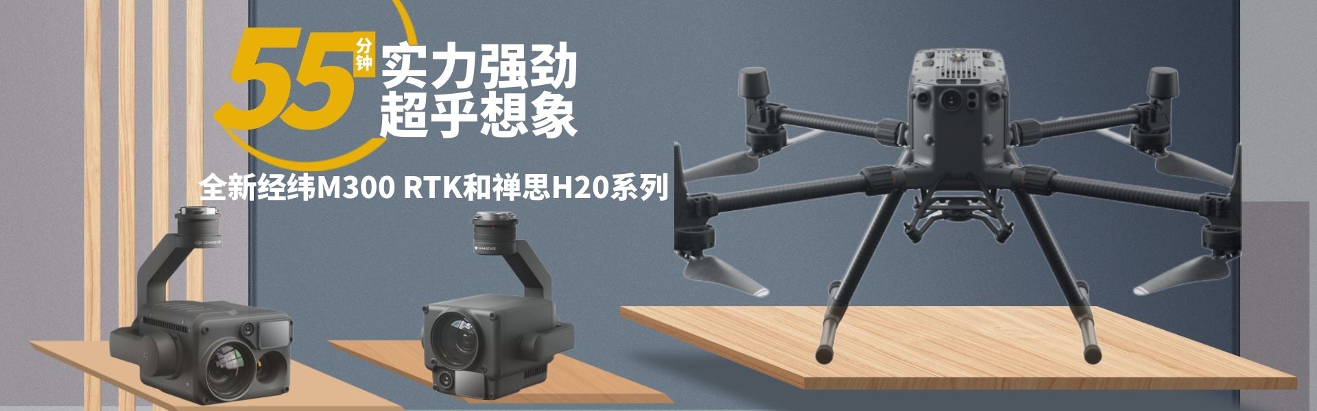
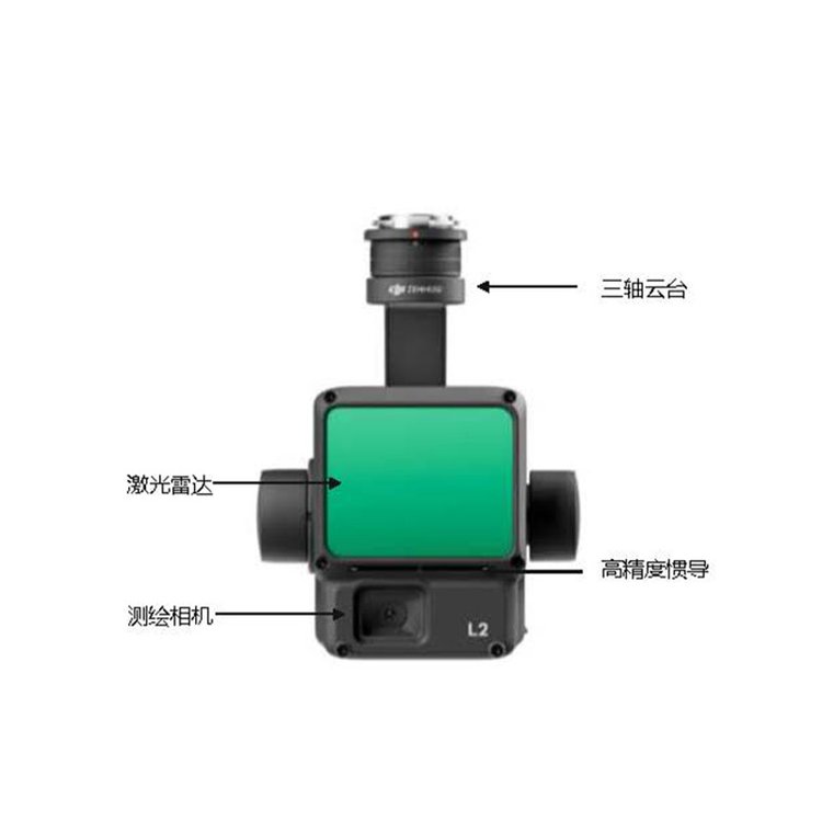
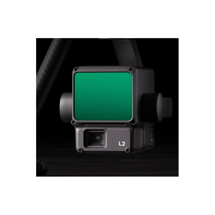
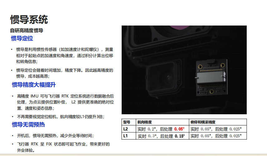
DJI ZenmuseL2Self-developed high-precision inertial navigation without inertial navigation preheating ShenzhenPengjin Technology's drone technology team, contact number: 183-2093-0028, Miss Lai The company offers a variety of drones./Laser Radar / Oblique Photogrammetry / Multispectral / Hyperspectral and other loading solutions > HighJINGDegrees, accuracy 5 Centimeters; > HighXIAORatio, an improvement over the previous generation 5 X2; > High penetration, capable of penetrating dense forests; > High range,500 Rice; > Five Echo; > Plug and play; > DJI SmartMap Post-Processing Free; Highly integrated and cost-effective new-generation airborne highJINGLaser Radar for Surveying and Measurement > Highly integrated: Frame-mounted LiDAR, high-precision self-developed inertial navigation system. Visible Light Mapping CameraMachine and three-axis tripod Waiting modules. > End-to-End Solution: Pair with DJI TerraMap Ready for 3D data acquisition and high-precision post-processing. Integrated solutions DJI ZenmuseL2Self-developed high-precision inertial navigation without inertial navigation preheating ShenzhenPengjin Technology drone technology team, contact phone number18320930028 Miss Lai The company offers a variety of drones./Laser Radar / Oblique Photography / Multispectral / Hyperspectral and other load solutions 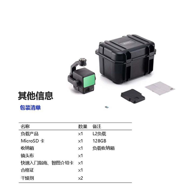

Phone Consultation
QQ Service