
 DJI Airport 3, deployable in vehicles for unmanned operations
 PJC8 Comprehensive Smart Pipeline Detector
 Daqi Tiancheng SHARE505S PRO 51 Megapixel Medium Format Aerial Camera
 Sel S10 Portable 3D Laser Scanner
 GHJS12 explosion-proof portable 3D laser scanner
 S10 Real-Time 3D Laser Scanner
 DJI Airport 2+ Platform + AI Software
Product Details
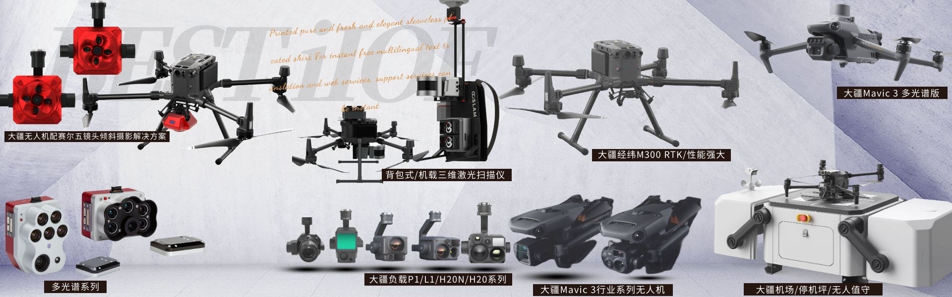
DJI drones and payloads, 3D laser scanners, ground-penetrating radar, multisp...
产品Price Negotiable
最小起订Quantity:1 Set 供货总Quantity: 20 Set


Maximum Takeoff Weight |
|
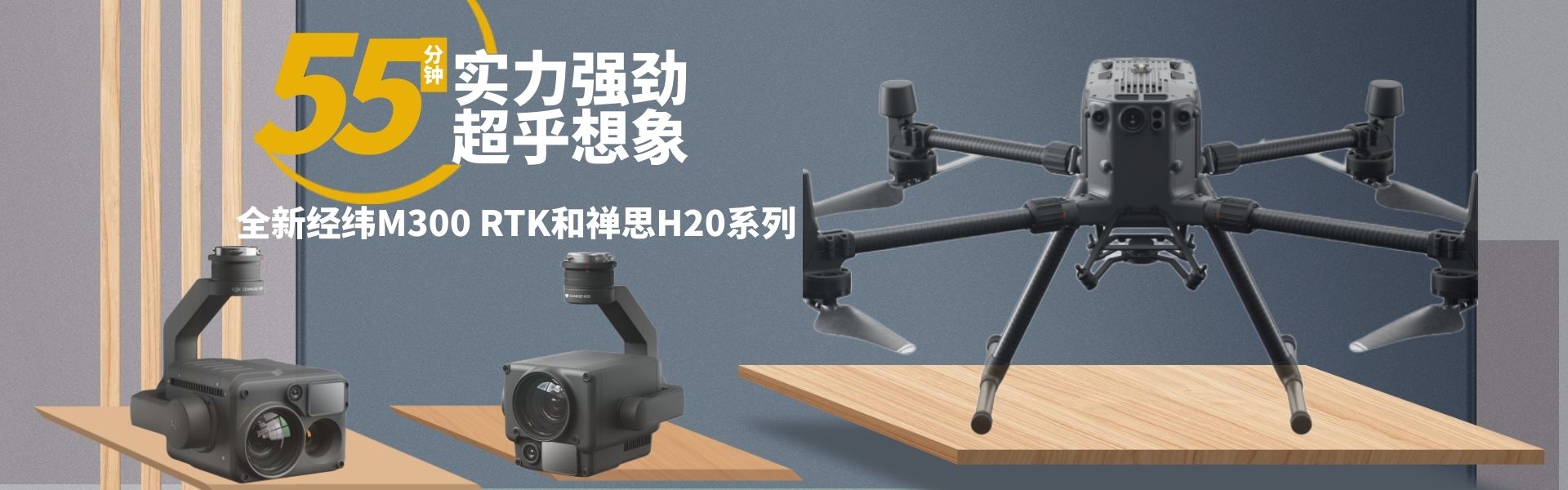
Longest flight time |
43 minutes |
Dimensions |
347.5 x 283 x 139.6mm |
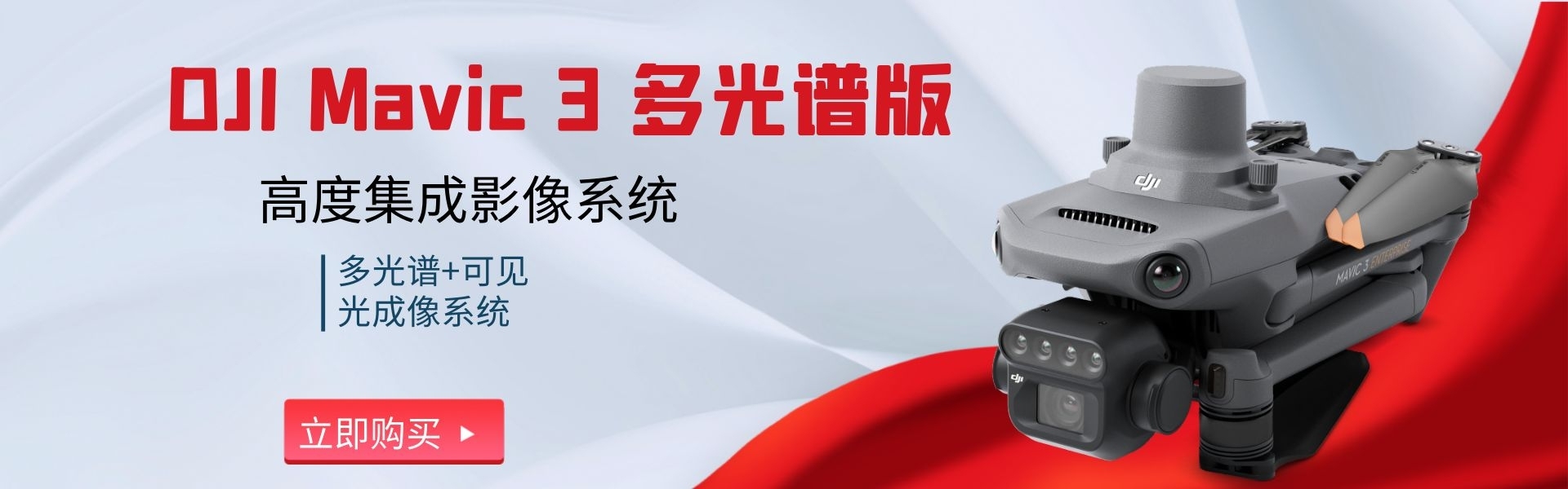
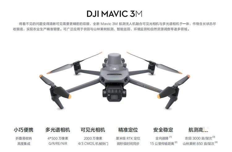
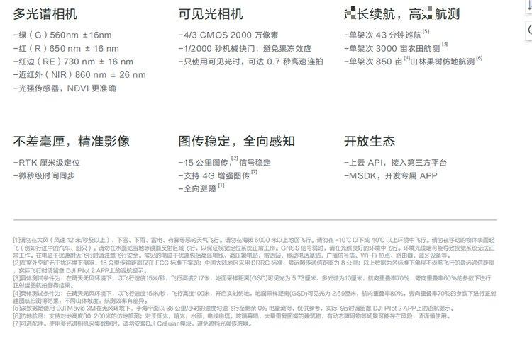
DJIMavic 3MMultispectral-Visible Light Highly Integrated Imaging System Shenzhen Pengjin Technology Co., Ltd. offers a variety of drone integration solutions and provides on-site demonstration services. Welcome to inquire.18320930028 Miss Lai It takes a more precise pair of eyes to make the unseen issues visible. The all-new Mavic 3M Aerial survey drones integrate visible light cameras with multispectral cameras, offering a comprehensive view of crop growth conditions for efficient agricultural management. Compact and portable Folding for easy storage Highly integrated Multispectral Camera 4*50020 Megapixels G/R/RE/NIR Visible Light Camera 4/3 CMOS, 20001 megapixel Mechanical shutter Positioning CentimetersRTKPositioning Picosecond time synchronization Secure and stable Omni-directional obstacle avoidance 15 Mile transmission distance Aerial Survey GAO Efficiency Farmland 3000 Mu (Chinese unit of area)/Unit flight Forest Fruit Trees 850 Mu (Chinese unit of area)/Flight Multispectral+Visible Light Imaging System Highly integrated imaging system Upgraded imaging system, featuring integrated 1 Unit2000 1 megapixel visible light camera and4 Individual500 100万像素的多光谱相机 (green, red, red edge, and near-infrared). Achieves highJINGAerial surveying, crop growth monitoring, and natural resource investigation applications. Light Intensity Sensor The fuselage integrates a multispectral light intensity sensor that can collect solar irradiance and record it in image files. It can compensate for lighting data during the two-dimensional reconstruction process, resulting in more accurate NDVI As a result, enhance the accuracy and consistency of data collected across different time periods. RTKModule Not a hair's breadth off, the image Mavic 3M SetRTK Modules, achieving centimeter-level accuracyJINGHigh-precision positioning. Flight control, camera, and RTK Module microsecond synchronization, acquiring the positioning information of each camera imaging center.Mavic 3M Achieve image control-free aerial survey even at high-speed flight. Signal stable, image transmission smooth O3 Image Transmission Integration2 Roadway transmitting signal and4 Road receives signal, supported15 Exceeding long-distance transmission in kilometers. Optional DJI Cellular Module4G Enhanced image transmission andO3 The industry version of the image transmission system operates simultaneously, ensuring stable signal even in environments with mountainous or building obstructions, thus enhancing flight safety. Omni-directional perception, mimic aerial survey Equipped with multiple wide-angle vision sensors, the aircraft detects obstacles in all directions, achieving omni-directional obstacle avoidance. In steep mountainous terrain scenarios, combined with the vision sensors beneath the fuselage, direct ground-following navigation and surveying can be realized, bringing about single-flight missions 850 Acreage forest and fruit tree aerial survey efficiency. Application Fields Aerial survey of fruit trees Utilize Mavic 3M Simulated aerial topography of forest orchards, compatible with DJI TerraPro Or DJI Smart Agriculture Platform[7]Rebuild the orchard high-definition map, capable of automatically identifying the number of trees, distinguishing between trees and obstacles, and generating 3D flight paths for agricultural drones for safer operations. Guidance Variable Operations For rice fertilization, cotton chemical control, and potato foliar application. Link, leveraging Mavic 3M Acquire multi-spectral imagery of crops. Compatible with DJI Terra or DJI Smart Agriculture Platform NDVIVegetation index, capturing differences in crop growth, generating prescription maps, and配合agricultural drones for variable application of fertilizers and pesticides, reducing costs and increasing yields while ensuring environmental sustainability. Smart Field Patrol Mavic 3M Automated field patrol operations can be conducted, with field patrol imagery available through4G Uploaded to the DJI Smart Agriculture Platform in real-time, promptly detect abnormal conditions such as missing seedlings, weeds, and lodging in the fields, and utilizeAlIdentify and perform intelligent analysis such as cotton seedling recognition and rice-wheat yield estimation, enabling real-time sharing of crop growth information, guiding agricultural activities, and allowing one person to easily manage thousands of acres of farmland. Environmental Monitoring and Natural Resource Survey Mavic 3M It can also be applied to the monitoring of eutrophication in water bodies, and forests. Surveys on distribution, urban green space areas, and environmental monitoring as well as natural resource investigations. Uploading to the cloud API Through Pilot 2 Built-inMOTT The agreement to Dajiang CloudAPlMay be usedMavic 3M Directly connect to third-party cloud platforms. No separate development required.APPThe system allows for the return transmission of drone equipment information, live video, photo data, and more. MSDK Mavic 3M SupportSDK 5(MSDK5)Full-featured open-source production-level codeSample。 Utilize MSDK5Develop dedicated controls for scenarios such as drone field patrols and intelligent monitoring.AppEasy to pick up and use. DJIMavic 3MMultispectral+Visible Light Highly Integrated Imaging System DJIMavic 3MMultispectral-Visible Light Highly Integrated Imaging System Shenzhen Pengjin Technology Co., Ltd. offers various drone integration solutions and provides on-site demonstration services. Welcome to inquire.18320930028 Miss Lai 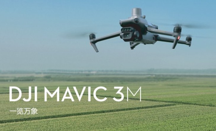

Phone Consultation
QQ Service