
 DJI Airport 3, deployable in vehicles for unmanned operations
 PJC8 Comprehensive Smart Pipeline Detector
 Daqi Tiancheng SHARE505S PRO 51 Megapixel Medium Format Aerial Camera
 Sel S10 Portable 3D Laser Scanner
 GHJS12 explosion-proof portable 3D laser scanner
 S10 Real-Time 3D Laser Scanner
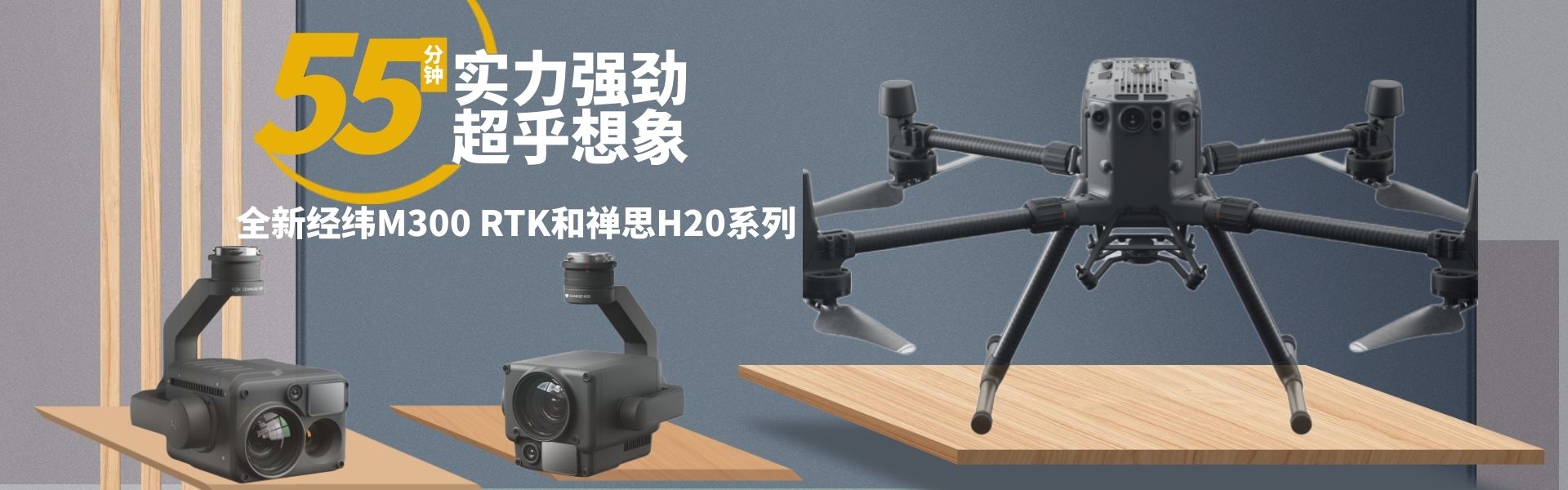
 DJI Airport 2+ Platform + AI Software
Product Details
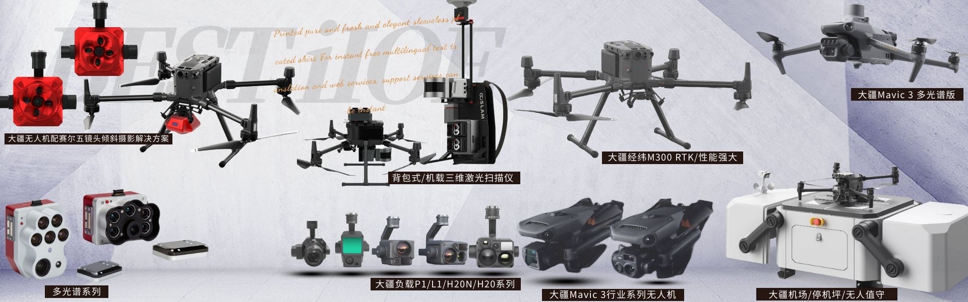
DJI drones and payloads, 3D laser scanners, ground-penetrating radar, multisp...
产品Price Negotiable
最小起订Quantity:1 Set 供货总Quantity: 20 Set


Maximum Takeoff Weight |
|
Maximum flight time |
43 minutes |
Dimensions |
347.5 x 283 x 139.6mm |
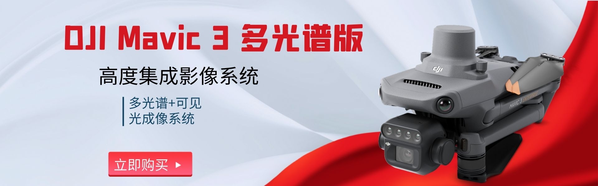
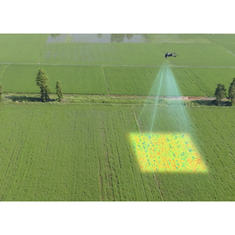
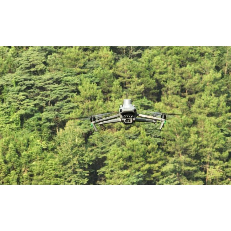
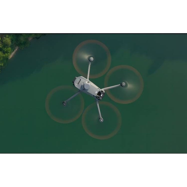
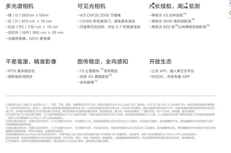
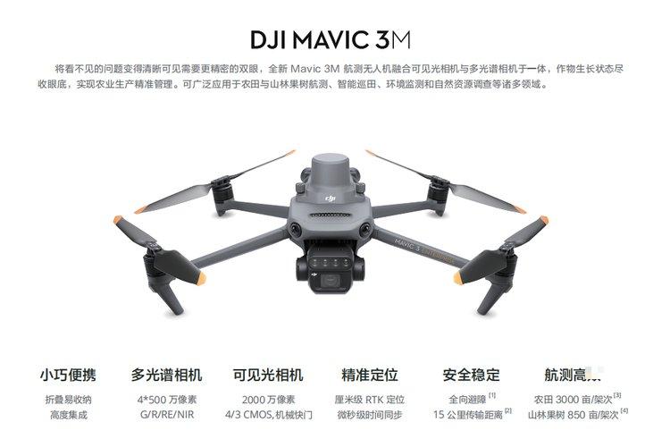
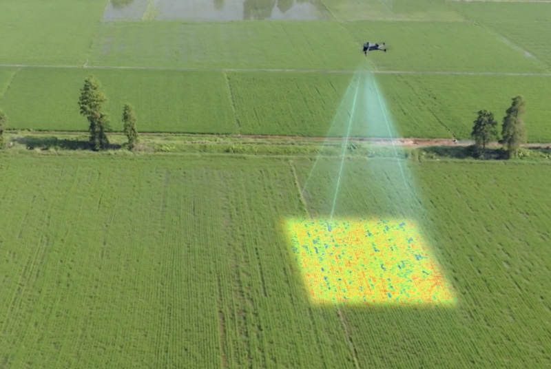
DJIMavic 3MIndustry-grade compact portable multispectral drone aircraft Shenzhen Pengjin Technology Co., Ltd. offers various drone integration solutions and provides on-site demonstration services. Welcome to inquire.18320930028 Miss Lai Highly integrated imaging systemUpgraded imaging system, integrated1 unit of a 20 million pixel visible light camera and 4 units of 5 million pixel multispectral cameras (green, red, red edge, and near infrared). Capable of high-precision aerial surveying, crop growth monitoring, natural resource investigation, and more applications. The camera body integrates a multispectral light intensity sensor that can collect solar irradiance and record it in image files, allowing for lighting compensation during the 2D reconstruction process to achieve more accurate NDVI results and improve the accuracy and consistency of data collected at different times. The RTK module ensures pinpoint precision; when paired with the RTK module, the Mavic 3M delivers centimeter-level high-precision positioning. Flight control, camera, and RTK module achieve microsecond synchronization, accurately obtaining the position information of each camera's imaging center, allowing the Mavic 3M to perform image control-free aerial surveying even at high speeds. Signal stability and smooth transmission; the O3 transmission system integrates two transmitting signals and four receiving signals, supporting ultra-long-range transmission of up to 15 kilometers. Optional DJI Cellular module, 4G enhanced transmission and O3 transmission industry version can work simultaneously, ensuring signal stability and safer flight even in environments with mountainous terrain or buildings. Omnidirectional perception; the ground-simulating aerial survey body is equipped with multiple wide-angle visual sensors, accurately detecting obstacles in all directions for omnidirectional obstacle avoidance. For steep mountainous terrain, combined with the visual sensors under the body, it can directly perform ground-simulating aerial surveying, bringing an efficiency of 850 mu (about 56.67 hectares) of forest and orchard aerial surveying in a single flight. DJIMavic 3MProfessional-grade compact portable multispectral drone platform Shenzhen Pengjin Technology Co., Ltd. offers a variety of drone integration solutions and provides on-site demonstration services. Welcome to inquire.18320930028 Miss Lai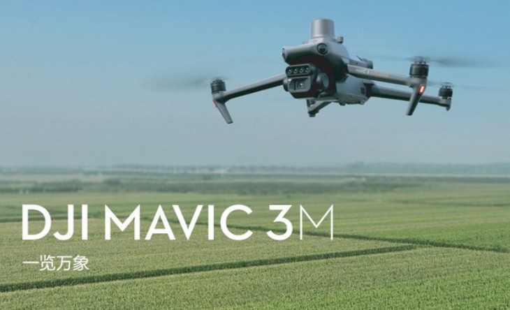


Phone Consultation
QQ Service