
 DJI Airport 3, deployable in vehicles for unmanned operations
 PJC8 Comprehensive Smart Pipeline Detector
 Daqi Tiancheng SHARE505S PRO 51 Megapixel Medium Format Aerial Camera
 Sel S10 Portable 3D Laser Scanner
 GHJS12 explosion-proof portable 3D laser scanner
 S10 Real-Time 3D Laser Scanner
 DJI Airport 2+ Platform + AI Software
Product Details
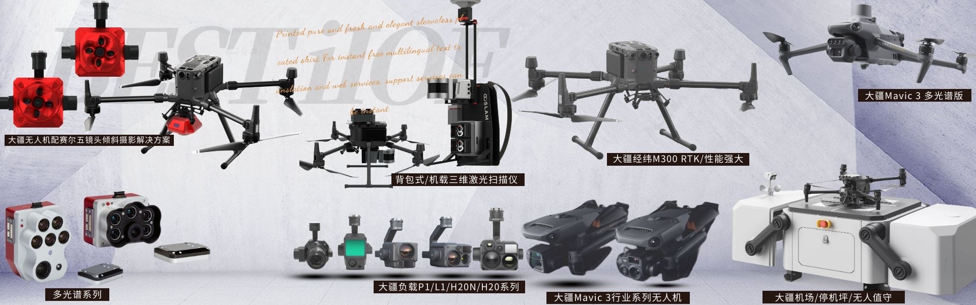
DJI drones and payloads, 3D laser scanners, ground-penetrating radar, multisp...


产品Price Negotiable
最小起订Quantity:1 Set 供货总Quantity: 20 Set


Dimensions |
|
Weight |
905 ± 5 grams |
System power consumption |
28 W (typical) / 58 W (max) |
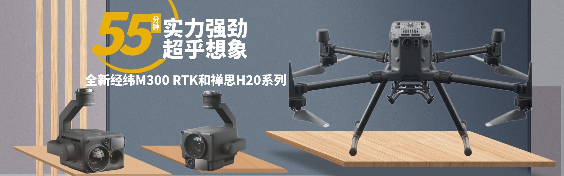
DJIM350Equipped with LiDARL2Open sky view, take in the big picture ShenzhenPengjin Technology's drone technology team, contact phone number18320930028 Miss Lai The company offers a variety of drones./Laser Radar / Oblique Photography / Multispectral / Hyperspectral and other loading solutions Next-generation airborne high-precision mapping LiDAR with high integration and cost-performance. > Highly integrated: Frame-mounted LiDAR, high-precision self-developed inertial navigation. Visible Light Mapping CameraMachine and three-axis tripod wait modules; > End-to-end solution: Pair with DJI Terra It becomes a solution for three-dimensional data acquisition and high-precision post-processing. Integrated solutions DJIThe M350 drone carries a high-precision mapping LiDAR system, integrating frame scanner LiDAR, high-precision in-house developed INS, and a 4/3 CMOS visible light mapping camera, granting DJI's flight platform enhanced precision, efficiency, and reliability in 3D data collection. Paired with DJI Terra, it offers an integrated solution for 3D data acquisition and high-precision post-processing. Aerial High-Precision Surveying Lidar ZenMuse L2 integrates frame-laser radar, high-precision self-developed inertial navigation, and a 4/3 CMOS visible light mapping camera, endowing DJI's flight platform with more precise, efficient, and reliable 3D data collection. Integrated LiDAR Solution Owing to hardware performance,L2 accurately scans small target objects and has an extended range, allowing for quick acquisition of precise point cloud data. During operations, staff can preview, replay, and assemble point cloud models on-site, and obtain field quality reports to efficiently carry out tasks. With DJI Terra's one-stop post-processing, high-precision point cloud results can be obtained. Smaller spot size, higher energy concentration Diameter of the light spot 4 x 12 cm @ 100 meters, just 1/5th of L1, it can not only identify smaller targets and obtain finer models but also penetrate thicker vegetation, generating more accurate digital elevation information. Support 5 Echo In areas with dense vegetation,L2 Provides access to a richer variety of forest floor points. Point cloud data rate 240,000 points/second In single echo and multi-echo modes,L2ZUIHigher cloud emission rates available 240,000 points/second, allowing for more point cloud data to be acquired within a unit of time. Two scanning modes L2 supports two scanning modes, allowing operators to flexibly choose according to their operational requirements. In the repetitive scanning mode, the laser radar can perform more uniform and precise scanning to meet high-precision surveying requirements. In the non-repetitive scanning mode, it has stronger penetrability, providing more structural information and is suitable for power line inspections, forestry surveys, and other operational scenarios. DJIM350Equipped with LiDARL2Open sky view, take in the big picture ShenzhenPengjin Technology UAS technical team, contact phone18320930028 Miss Lai The company offers a variety of drones./Laser Radar / Oblique Photogrammetry / Multispectral / Hyperspectral and other Load Solutions 


Phone Consultation
QQ Service