


- AllProduct Category
-
Genetic Resource Database
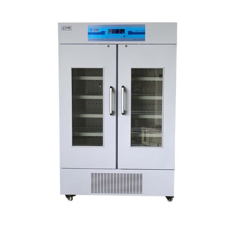
Artificial Climate Chamber
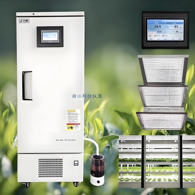
Light Culture Incubator
Artificial Climate Chamber
Smart Mold Incubator
Intelligent Biochemical Incubator
Ultra-Low Temperature Cold Storage
Ultra-Low Temperature Refrigerator
High-Precision Low-Temperature Constant-Temperature Bath
Comprehensive Stability Test Chamber for Pharmaceuticals
Agricultural Special Purpose Equipment


Recommended Products


详情描述
I. Application Used for plants (various trees, fruit trees, etc.)
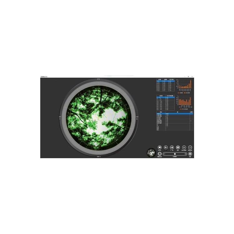
Combine with canopy images of crops in the mid-late growth stages
Multi-parameter, batch automated analysis.
Section 2: Key Technical Specifications
1Compact and portable, easy to operate
Non-destructive canopy hemispherical collection everywhere
Image.
Lens Field of View: Fish-eye lens
Wide-angle lens
Measurement Range: Zenith Angle from0°~90°
Available for segmentation3~30A region, azimuth360°
May also be divided3~30Various regions, front-facing mobile phones
Camera Resolution:≥8001. 1 Megapixel, operating temperature:0~55℃。
2Electrically adjustable for azimuth and level, capable of automatically maintaining direction and locking level (mobile)APPAssist in accurately locating (after auxiliary alignment).
3You can arbitrarily define the image analysis area (the zenith angle can be segmented)30Area, bearing angle divisible30Zone.
4Tree trunks of thicker trees can be obscured, by8-24Take photos at each decimal angle to automatically composite a canopy map that ignores trunk obstructions. Both manual and automatic methods are available to screen out unreasonable divisions.
5Automatically separates canopy from sky, with manual fine-tuning support.
6Built-in up to9This analytical method allows for multi-parameter, batch-processed automated analysis.
7Records the latitude, longitude, and altitude of the collection location, and parses the specific address based on the coordinates.
8Available from collection locationGPSLocate on the map and mark the results.
9Supports multiple map sources including Gaode Map, Gaode Satellite Map, Google Map, and Google Satellite Map.
10Measurable indicators:
(1Leaf Area Index
(2Leaf Average Inclination Angle
(3Total Porosity
(4Cespitose index
(5Canopy openness
(6Canopy closure density
(7Open space availability
(8)UOCModelsSOCLight distribution represented by the model
(9Canopy pore volume at different solar altitude angles
(10Atmospheric Extinction Coefficient of Plant Canopies Under Different Solar Altitudes
(11Spatial distribution of leaf area density
(12Location Information (Latitude, Longitude, Address, etc.)
Section 3: Standard Configuration
1Plant Canopy Image Analyzer System Software CD and Software Lock1Set
2Handheld Automatic Stabilizer1A
3Fish-eye lens1A
4Wide-angle lens1Unit
5Pre-positioned16001. 1 Megapixel smartphone1Tai
IV. Other
1This product requires a computer to operate.
2Optional accessoriesPARPhotosynthetic Active Radiation Meter (Sensor Spectral)400nm~700nmRange0~2000μmol/㎡•S)
询价单


